$ ls -la ./projects
Portfolio
Personal projects, open-source and work in progress.
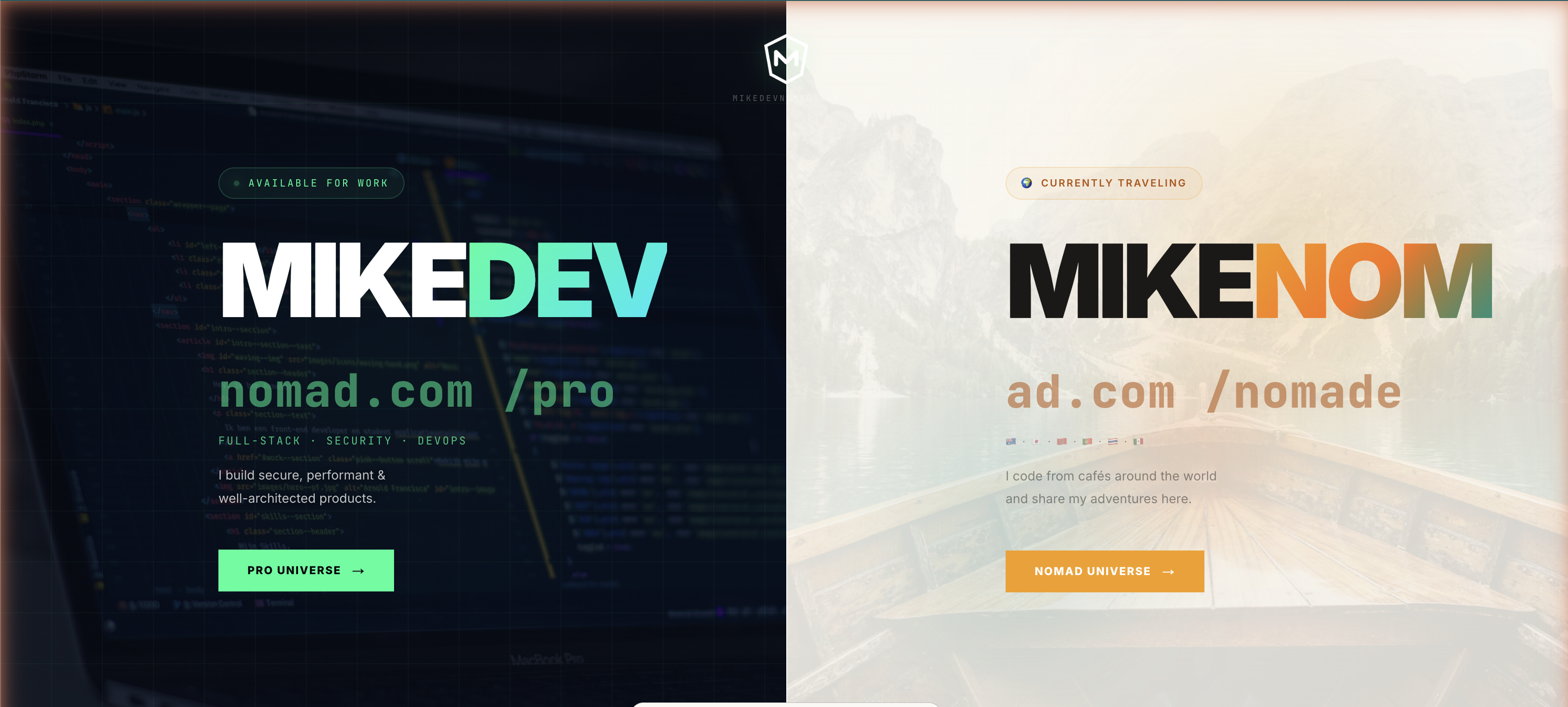
MikeDevNomad — Split Portfolio (Pro & Nomade)
Personal Portfolio Website — Two Universes, One Identity A full-stack personal website built from scratch with a unique split-screen concept: two identities, one domain. MIKEDEV /pro — the professional side: Full-stack developer portfolio (projects, skills, experiences) Cybersecurity section with CTF write-ups "Available for work" status MIKENOM /nomade — the adventurer side: Travel stories and adventures from around the world "I code from cafés around the world" Under the hood: Custom admin dashboard to manage all content
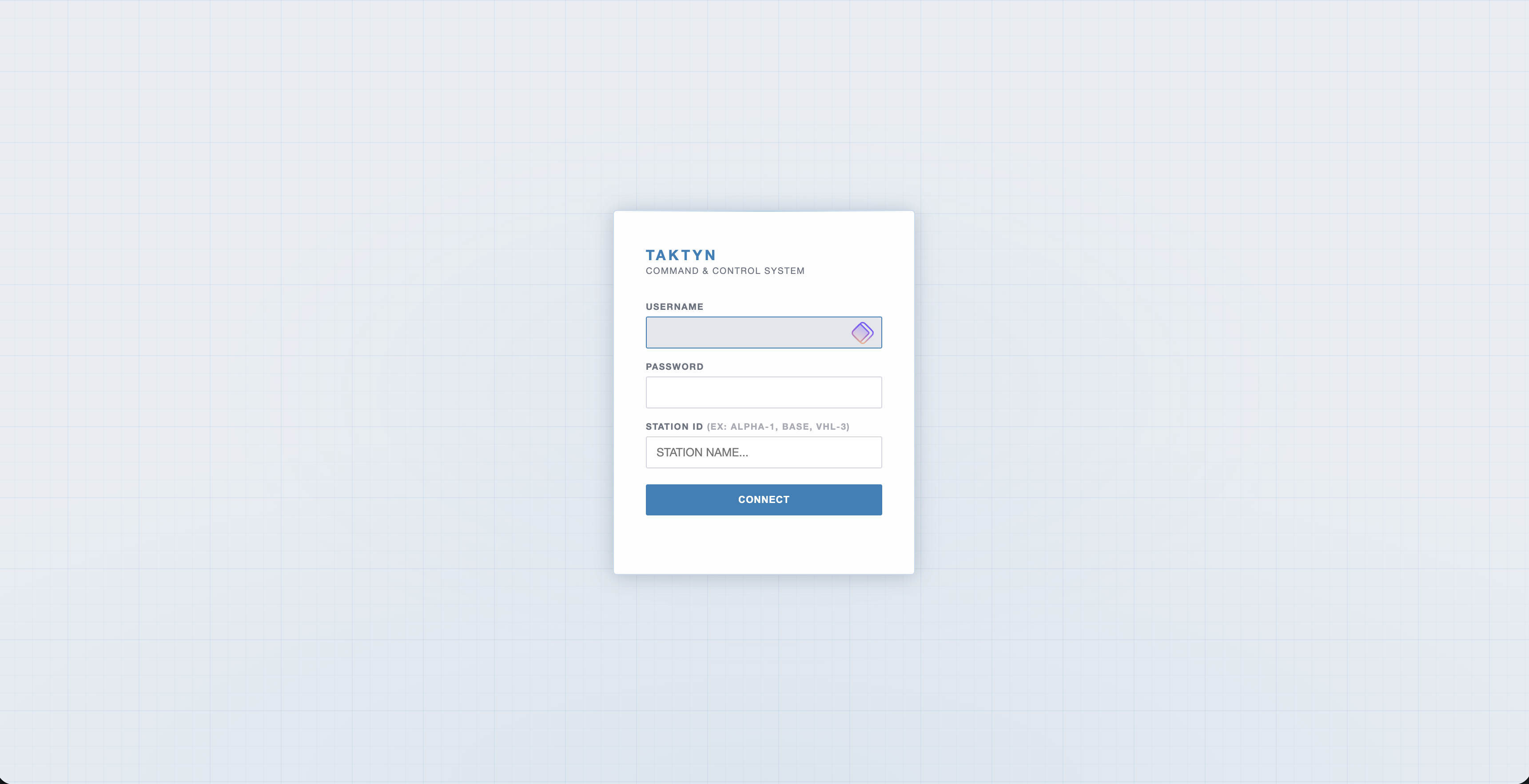
TAKTYN Real-Time Tactical Coordination Web App
TAKTYN is a full-stack web application designed for real-time field team coordination and tactical command. It provides an interactive live map with unit tracking, a built-in chat system with urgent messaging, and full operation management with user roles. One of its key strengths is its multi-network architecture: the app runs over 4G/5G on Android tablets in the field, but can also operate completely without internet thanks to its integration with Meshtastic — an open-source radio mesh network. This means teams can communicate and share their positions even in areas with zero cellular coverage, using only USB or Bluetooth-connected radio devices. The app was designed to remain functional in degraded or offline conditions. --- Key Features Map & Situational Awareness Interactive map powered by Leaflet.js with multiple tile sources: Swisstopo, Swisstopo Satellite, OpenStreetMap, ESRI Satellite, Dark Tactical Place and manage markers and units directly on the map Draw sectors, lines/arrows, and zones for mission planning Distance measurement tool Adjustable map brightness Offline tile download for use in areas without connectivity Team Communication Integrated chat with broadcast and direct messaging Urgent message flag for critical communications GPS position sharing with configurable update frequency Operations Management Create, open, and import/export operations Multi-operation support with user assignment Unit status tracking: Active, Moving, Contact, Standby, Maintenance, Medevac, Out Admin Panel User management System logs Export PDF mission reports Database encryption (Security — DB Encryption) Network Module 4G/5G relay monitoring and configuration (for Android tablets in the field) USB Radio via Meshtastic — enables full operation without any internet connection BLE Radio via Android — Bluetooth-based connectivity TX status and connected clients monitoring Reports Create reports from templates Access report history --- Tech Stack | Layer | Technology | |---------------------|-----------------------------------| | Frontend | React / Vue.js (add yours here) | | Map | Leaflet.js | | Map tiles | OpenStreetMap, Swisstopo, ESRI | | Real-time | WebSocket / Relay server | | Radio (no-internet) | Meshtastic (USB) | | Bluetooth | BLE — Android | | GPS | Browser Geolocation API + radio | | Export | PDF generation | | Security | Database encryption | | Platform | Web + Android tablet (4G) | --- What Makes It Stand Out Works without internet — Meshtastic radio integration means the app functions in zero-coverage environments, a rare and technically challenging feature Multi-network fallback — seamlessly switches between 4G, BLE, and radio depending on what's available Field-ready UI — dark tactical interface designed for real operational use Offline map tiles — the map keeps working even when the server is unreachable Complete command system — not just a map, but a full coordination platform with chat, user roles, reports, and encrypted data --- Tags / Keywords Web App · Leaflet.js · Real-Time · GPS Tracking · Meshtastic · Mesh Radio · 4G · Android · Offline-First · Tactical UI · Full Stack · Field Operations · Dark UI ---